SOLOMON ISLANDS TSUNAMI ON THE
WEST COAST OF NEW ZEALAND
6-FEBRUARY-2013
Jose C. Borrero, eCoast Ltd.

SOLOMON ISLANDS TSUNAMI ON THE
WEST COAST OF NEW ZEALAND
6-FEBRUARY-2013
Jose C. Borrero, eCoast Ltd.
Comparison to the 2007 Solomon Islands ‘Gizo’ event
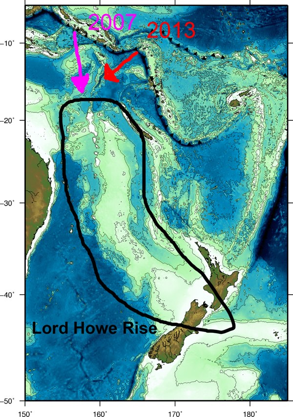
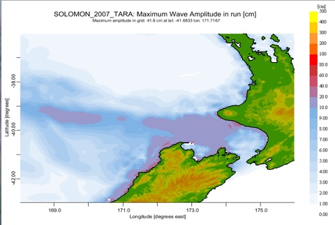
In the course of discussions during the 2013 event, William Power (GNS) noted that the modeling results were suggesting waves from the 2013 event would much smaller than what was observed during the 2007 Solomon Islands tsunami, yet both events were of roughly the same magnitude. However the 2007 event was located further to the west. The source models used by NOAA for the 2007 (DART constrained) also suggested a shallower fault, 200 km long by 50 km wide whereas the DART constrained model for 2013 was set at 100 km long x 100 km wide with more slip on the deeper segment.
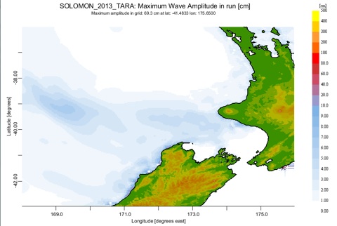
2013 Prediction
2007 Hindcast
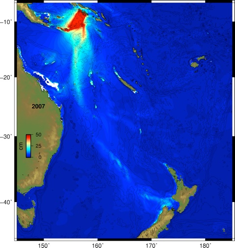
The effect of the source location can be seen in the plots below. I ran the full propagation over 3-min GEBCO down sampled bathymetry. The more western source pushes more energy on to the Lord Howe Rise and guides it to the West Coast of NZ. This is an important consideration for future events in this region. Consider a shallow 8.6 (or larger!) just to the east of the 2007 source. That could be a concern for NZ west coast interests.
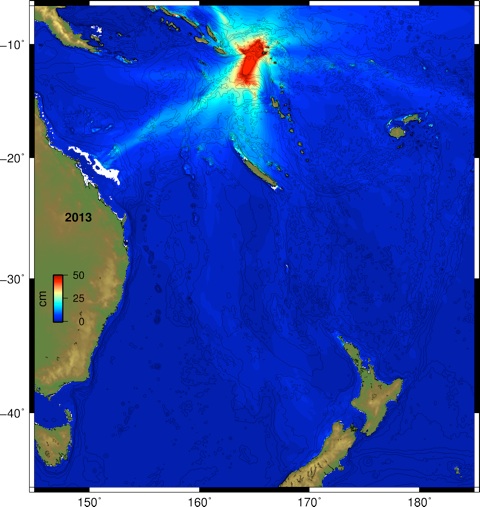
2013
2007
